Document Type: |
|
||
Author/editor: |
[Mercator, Gerhard] Standard: Mercator, Gerhard [Mercator, Gerard] |
||
Title:
|
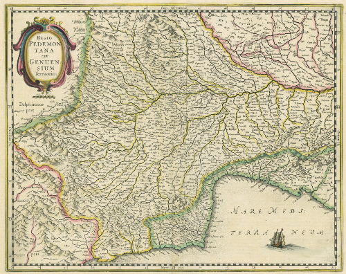
Regio Pedemontana cum Genuensium Territorio
Standard: |
||
Collective work: |
Atlas, or A Geographicke description of the Regions, Countries, and Kingdomes of the World : through Europe, Asia, Africa, and America, represented by new & exact Maps | ||
Date of Publication: |
[1636] | ||
Physical description/Number of edition: |
Incisione | ||
Format : |
mm. 358 x 451 | ||
Holdings Information: |
Archivio Storico della Città di Torino, coll. cartografica, 26 | ||
Subjects: |
Western Alps - Geographical Maps - 1636 |
||
Table of contents: |
Titolo in alto a sinistra, in un medaglione decorato. |
||
Summary/Notes: |
Contenuta in: G. Mercator, Atlas or A Geographicke description of the Regions... Riedizione, con nuovo titolo e cartiglio, della carta del Mercatore: “Pedemontana Regio cum Genuensium territorio et Montisferrati Marchionatu” del 1589 (cfr.), ripubblicata più volte in vari atlanti. La Val d’Angrogna è ancora situata a sud della Val Luserna. Bibliografia: F. Barrera, Il Piemonte nella cartografia del Cinquecento e Seicento, n. 27 (edita da I. Janssonius) ; Torino e il suo orizzonte, n. 29. |
||
Su concessione dell'Archivio Storico della Città di Torino |

